A topographic survey is one of the most underestimated steps in any construction project in Bali. Many developers and landowners focus entirely on soil testing, yet they skip the one tool that tells every engineer exactly how the land sits, slopes, and drains. Without accurate contour data, even the best foundation design can fail to account for real terrain conditions.
In Bali, land shapes vary dramatically. You will find steep hillside plots in Ubud, cliff edges in Uluwatu, low-lying coastal areas in Seminyak, and volcanic ridgelines across the inland regencies. A professional topographic survey Bali captures all of this detail precisely, so your team can plan drainage, calculate earthworks, and finalise building layouts with full confidence.
Understanding Topographic Survey: Benefits for Construction Planning in Bali
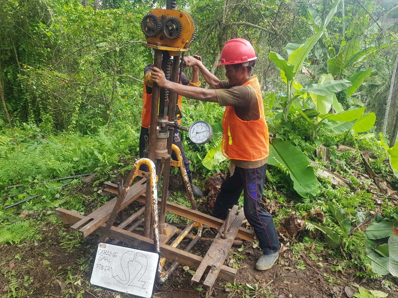
A topographic survey is the systematic measurement and mapping of the earth’s surface, capturing elevation, contour lines, natural features, and man-made structures using GPS and Total Station instruments. According to the US Army Corps of Engineers Engineering Manual EM 1110-1-1005 on Control and Topographic Surveying, topographic data is the foundational reference layer for all civil engineering design, earthwork estimation, and drainage planning. This is precisely why every construction project in Bali, from a small private villa to a large resort development, should begin with one.
What Is a Topographic Survey and Why Does It Matter?
A topographic survey Bali does more than draw a simple outline of your land. It records every change in elevation across the site, producing contour lines that engineers use to understand slope direction, gradient, and natural drainage paths. This data is collected using GPS receivers, Total Station theodolites, or drone-based LiDAR systems, depending on site size and required accuracy.
The output is a digital terrain model with spot levels, cross-sections, and benchmark reference points. Architects use this data to determine where the building sits relative to natural ground level. Structural engineers use it to calculate cut and fill volumes before any excavation begins. Without this, your contractor is essentially guessing how much soil to move and in which direction.
Key Components of Topographic Survey Data
When Indo Soil delivers a topographic survey report, it contains several essential data layers that serve different purposes across your project team. Each layer is critical in its own way, and together they form a complete picture of your land.
| Data Component | What It Shows | Who Uses It | Why It Is Important |
|---|---|---|---|
| Contour Lines | Elevation changes across the site at set intervals | Architects, structural engineers | Defines slope direction and gradient for layout planning |
| Spot Levels | Precise elevation at individual measured points | Civil engineers, contractors | Used to calculate cut and fill volumes accurately |
| Benchmark Points | Fixed reference elevations tied to a datum | All site engineers | Ensures all design levels are consistent throughout the project |
| Cross Sections | Vertical slice profiles across the land | Drainage and road designers | Shows how the terrain varies along a given alignment |
| Land Feature Mapping | Trees, existing structures, boundaries, water features | Architects, planners | Ensures new design avoids conflicts with existing features |
Benefit 1: Accurate Cut and Fill Planning
One of the most direct and financially significant benefits of a topographic survey Bali is its role in earthwork calculation. Cut and fill refers to the process of excavating elevated ground (cut) and using that material to raise lower areas (fill). Without accurate elevation data, your contractor cannot price this correctly, and the final cost can escalate dramatically.
When Indo Soil delivers your topographic report in DWG and PDF format, your civil engineer can calculate exact cut and fill volumes using the contour data. This reduces both over-excavation and unnecessary material transport, saving real money before a single foundation is poured. For sloped plots in areas like Canggu hillside zones or the terraced rice field edges in Ubud, this calculation is especially critical.
Benefit 2: Drainage Design That Works from Day One
Poor drainage is one of the leading causes of structural damage in Bali’s tropical climate. When rainwater cannot flow efficiently away from a building, it collects around the foundation, increases soil saturation, and accelerates settlement. A topographic survey prevents this by showing engineers exactly where water will naturally flow across your site.
According to Eurocode 7 (EN 1997-1), geotechnical design must account for groundwater conditions and drainage as part of the site investigation process. Your topographic data directly feeds into this requirement. By mapping slope directions and low points, your drainage engineer can design channels, sumps, and retention systems before construction, not as an afterthought after flooding occurs.
Benefit 3: Foundation Layout and Building Positioning
Your architect needs to know exactly where natural ground level sits before deciding where to place a building footprint. A topographic survey Bali makes this possible by providing a real terrain model, not a guessed approximation. The difference between placing a building 50 cm higher or lower on a sloped site can mean thousands of dollars in additional retaining wall costs, or savings of the same amount.
The International Society for Soil Mechanics and Geotechnical Engineering (ISSMGE) consistently emphasises that site characterisation, including surface topography, must precede all subsurface investigation and foundation design. This principle applies equally to the hillside villas of Seminyak, the cliff-edge resorts of Pecatu, and the low-rise developments along the Denpasar bypass corridor.
Benefit 4: Supporting Permit Applications (PBG and SLF)
In Indonesia, both the Building Approval Permit (PBG) and the Function Eligibility Certificate (SLF) require technical site documentation as part of the submission process. A certified topographic survey report is one of the standard supporting documents requested by local authorities in Badung, Denpasar, Gianyar, and other Bali regencies.
Submitting accurate site maps alongside geotechnical data demonstrates that your project meets the technical standards expected by regulators. Indo Soil produces topographic outputs in both DWG and PDF formats, both of which are accepted formats for permit documentation. This accelerates the review process and reduces the risk of rejection or revision requests from the planning authority.
Professional Soil Test and Sondir Services in Bali
Best Soil Test Services in Denpasar, Bali
Need a Topographic Survey for Your Bali Project?
Indo Soil delivers certified topographic survey reports in DWG and PDF format within 5 to 7 working days. Serving Bali, Lombok, NTB, and NTT.
Benefit 5: Slope Stability and Risk Assessment on Complex Terrain
For hillside, cliff-edge, and terrace plots across Bali, a topographic survey is the first data input needed before any slope stability analysis can begin. Your geotechnical engineer needs to know the existing slope angle, crest elevation, and toe elevation before calculating the factor of safety against sliding or overturning.
The FHWA Geotechnical Engineering Circular No. 5 published by the US Department of Transportation identifies topographic data as a prerequisite for identifying and evaluating geotechnical hazards on sloped sites. Indo Soil combines topographic survey data with CPT and boring test results to produce full slope stability reports for clients developing on complex terrain in Uluwatu, Petang, and the Nusa Penida cliffs.
Benefit 6: When Is a Topographic Survey Required in Bali?
Not every project requires the same level of survey detail. However, there are specific site conditions and project types where a topographic survey Bali is not optional but essential. Understanding when you need one helps you plan your pre-construction budget correctly and avoids delays during the design phase.
| Site Condition or Project Type | Is Survey Required? | Primary Reason |
|---|---|---|
| Sloped or hillside land (gradient above 5 degrees) | Yes, essential | Cut and fill calculation, slope stability input |
| Cliff-edge or ravine-adjacent plots | Yes, essential | Foundation setback and retaining wall design |
| Flat coastal or low-lying land | Recommended | Drainage planning and flood risk assessment |
| PBG or SLF permit application | Yes, required | Official site map documentation for regulators |
| Resort or commercial development above 500 m2 | Yes, essential | Multiple building positioning, road alignment, services layout |
| Residential villa on irregular lot | Recommended | Accurate building layout and drainage routing |
Topographic Survey Output Formats: DWG and PDF
Indo Soil delivers all topographic survey results in two standard formats. The DWG file is a full AutoCAD-compatible drawing that your architect and engineer can import directly into their design software. It contains all surveyed layers, including contours, spot levels, benchmark points, and existing features. The PDF file is a presentation-quality plot suitable for client review, permit submission, and project filing.
Both formats are produced from the same field dataset. Your structural engineer can immediately begin using the DWG file to position building footprints accurately on the real ground model, while your architect uses it to finalise levels, step heights, and terrace layouts. This dual-format delivery is standard across all Indo Soil topographic packages, without any additional fee.
Professional Soil Test Bali: Sampling Procedures Explained
Electromechanical vs Mechanical Sondir CPT in Bali
Indo Soil Topographic Survey Packages in Bali
Indo Soil offers transparent, fixed-price topographic survey services with no hidden fees. All packages include on-site fieldwork, data processing, report preparation, and delivery in DWG and PDF formats within 5 to 7 working days.
| Package | Price (IDR) | What Is Included | Best Suited For |
|---|---|---|---|
| Topographic Survey | Rp 4,500,000 | GPS/Total Station fieldwork, contour mapping, spot levels, benchmark points, DWG and PDF output | Single residential plots, drainage design, permit documentation |
| Business Starter (Survey + Soil Test) | Rp 7,500,000 | Topographic survey combined with 3-point CPT/Sondir (0 to 5 m), full technical report in English and Bahasa Indonesia | Commercial projects, mid-size developments, investors needing both datasets |
| Custom Large Project | Contact for quote | Extended survey area, drone LiDAR option, integration with boring test and slope stability analysis | Resorts, infrastructure, cliff-edge developments, multi-building sites |
How Soil Testing Protects Your Property Investment in Bali
What Every Bali Property Investor Must Know About Soil Conditions
Conclusion
A topographic survey Bali is not a luxury step reserved for large developments. It is a practical, cost-effective input that every construction project benefits from, regardless of size. By capturing real elevation data before design begins, you give your entire project team the accurate foundation they need to make better decisions on layout, drainage, earthworks, and foundation levels.
As established under ASTM D3441 and supported by ISSMGE guidelines on in-situ site characterisation, surface survey data works together with subsurface investigation to produce a complete geotechnical picture of your site. Indo Soil provides both capabilities in a single, coordinated service. Therefore, whether your land is flat, sloped, coastal, or perched on a cliff, you can proceed with clarity and confidence.
Contact Indo Soil today and let us design the right survey approach for your land.
Frequently Asked Questions
Q1: What is the difference between a topographic survey and a boundary survey?
A boundary survey establishes the legal boundaries and ownership limits of a parcel of land. A topographic survey, by contrast, focuses on the physical shape and elevation of the land surface, including slopes, drainage patterns, and existing features. Both serve different purposes, and many construction projects require both at the planning stage.
Q2: How long does a topographic survey take in Bali?
For a standard residential or small commercial plot, fieldwork is typically completed within one working day. Data processing, drafting, and report delivery by Indo Soil takes 5 to 7 working days from the date of fieldwork, depending on site size and level of detail required.
Q3: Do I need both a topographic survey and a soil test before building?
Yes. These two investigations answer different questions. A topographic survey Bali tells you about the surface shape and elevation of your land. A soil test, such as a CPT or boring test, tells you about the load-bearing capacity and stratification of what lies beneath the surface. Together, they provide your structural engineer with everything needed to design a safe and cost-efficient foundation. Learn more about what a soil test reveals.
Q4: Can a topographic survey be done using a drone in Bali?
Yes. Indo Soil can offer drone-based LiDAR or photogrammetric surveys for larger sites where ground-based Total Station access is difficult, such as steep cliff areas or densely vegetated plots. For standard residential and commercial plots, GPS and Total Station equipment is used, which produces the level of accuracy required for engineering design and permit submission.
Q5: Is a topographic survey report accepted for PBG and SLF applications in Bali?
Yes. Certified topographic maps produced by a qualified survey firm are accepted as part of the technical documentation submitted for PBG and SLF applications in Bali regencies including Badung, Denpasar, Gianyar, and Buleleng. Indo Soil reports are prepared by experienced engineers and are formatted to meet standard documentation requirements. Read why clients choose Indo Soil for geotechnical services in Bali.
Get Your Topographic Survey Quote Today
Tell us about your land and project type. Indo Soil will recommend the right survey approach and deliver your report within 5 to 7 working days. No hidden fees, no commitment required.
